Otsing

Kuvatakse päringule map vastavad postitused asjakohasuse alusel. Sortimine kuupäeva alusel Vaadake kõiki postitusi

#30DayMapChallenge

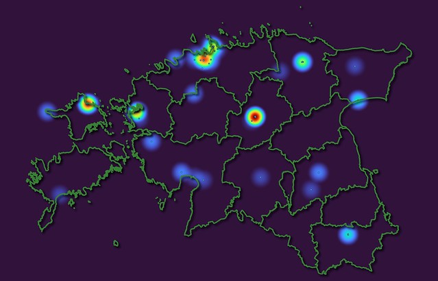
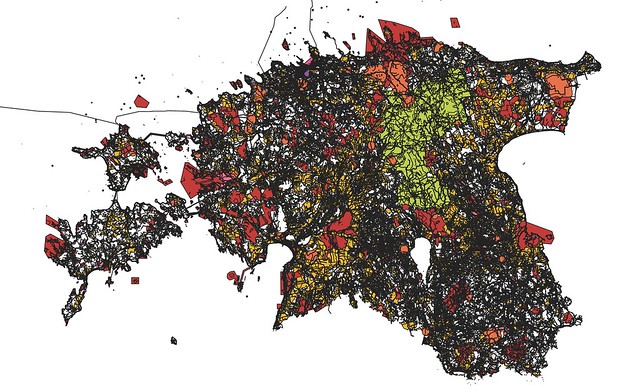
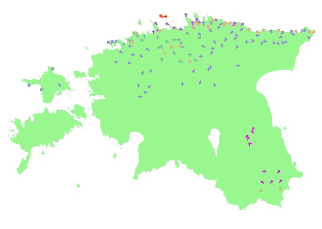
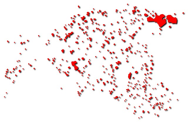
Crime network tool showing related mining sites by miners according to metadata of Estonian minerals usage permissions. #30DayMapChallenge 30.11.2021 Metamapping Water monitoring data marked as NULL in most of the water wells. Estonia. #30DayMapChallenge 29.11.2021 NULL Flatness depends on the projection #30DayMapChallenge 28.11.2021 The Earth is not flat Heat map of heat wells in Estonia #30DayMapChallenge 27.11.2021 Heatmap Lakes classified by height. Estonia. #30DayMapChallenge 26.11.2021 Choroplet map Land use restrictions in Estonia #30DayMapChallenge 22.11.2021 Boundaries Static water level in wells in Estonia  #30DayMapChallenge 21.11.2021 Elevation Directions of groundwater movement classified by aquifers. Estonia. #30DayMapChallenge 20.11.21 Movement 2222 Estonian islands. #30DayMapChallenge 19.11.2021 Islands. twitter#30DayMapChallenge

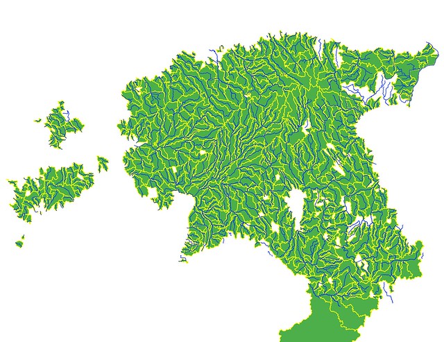
New tool density map. Estonia #30DayMapChallenge 14.11.2021 New tool Minerals in Estonia #30DayMapChallenge 13.11.2021 Natural earth All people in Estonia counted #30DayMapChallenge 12.11.2021 Population Elevation map of Estonia #30DayMapChallenge 10.11.2021 Raster Elevation. Estonia #30DayMapChallenge 9.11.2021 Monochrome Lakes in Estonia #30DayMapChallenge 8.11.2021 Blue Protected nature in Estonia #30DayMapChallenge 7.11.2021 Green Permission to mine. Estonia #30DayMapChallenge 6.11.2021 Red Water outlets, water cleaning stations and wastewater collection areas in Estonia on OpenStreetMap #30DayMapChallenge 5.11.2021 Openstreetmap Springs and water wells in Estonia #30DayMapChallenge 04.11.2021 Islands Drainage basins of Estonian rivers #30DayMapChallenge 03.11.2021 Polygons Pumphouses and water wells in Estonia #30DayMapChallenge 1.11.2021 Points #30DayMapChallenge
#30DayMapChallenge #30DayMapChallenge
Allikas: Avaandmed; Inspire; EC, OSM, Flickr

Paper: POST-STRIPPING PROCESSES AND THE LANDSCAPE OF MINED AREAS IN ESTONIAN OIL SHALE OPEN CASTS

1.1 POST-STRIPPING PROCESSES AND THE LANDSCAPE OF MINED AREAS IN ESTONIAN OIL SHALE OPEN CASTS [SLIDES] I. VALGMA The present study describes creating a digital map of oil shale surface mining technology and evaluating mining influences on the landscape. The data from the digital map of the Sirgala open cast show a constant increase in the overburden thickness. Overburden material thickness influences directly the future landscape but it also sets limits to stripping equipment parameters and productivity. The present open cast landscape was divided into four classes: afforested area, area with poor vegetation, graded area, and spoils. The second purpose of the study is saving information in an easily accessible form for the future. For this purpose geographic information system for mining is used. Introduction The minerals of Estonia are excavated in the amount of 10.5 million m3 per year. Yearly 7.4 million m3 of oil shale is mined, and half of this is mined in the open cast mines. The total surface mining amount in Estonia is 6.7 million m3 per year, and 54 % of it stands for oil shale mining. From this data a general rule follows: 1/3 of the volume of mined minerals comes from oil shale underground mining, 1/3 from oil shale surface mining, and 1/3 from surface mining of other minerals. Mining areas could be divided into five reclamation categories. First - mud excavation area - where mining takes place under water, is no subject for reclamation. Second - clay mining pits - are reclaimed to water storages, ponds or landfills. Third - sand and gravel quarries - are graded or formed as ponds. Fourth - limestone and dolostone quarries - form relatively deep ponds or are filled with waste. Among small-scale mining their reclamation is the most problematical one. Fifth - oil shale, phosphate rock and peat mining areas - are large due to thin horizontal bedding and require special reclamation. The largest Estonian surface mines are described as an example of large-scale mining operations and post-stripping processes. These open cast mines are largest by both area and production capacity and so cause also the largest influence to the environment and landscape. These three are the Aidu, Sirgala and Narva oil shale open casts, situating in the deposit wings where overburden thickness is smallest (Fig. 1). On the whole 120 km2 of overburden have been stripped in these mines. Fig. 1. Estonian oil shale deposit Calculations and charts in the present paper describe mostly the Sirgala open cast as the largest open cast mine in Estonia. Detailed description of the past processes in the mined-out areas let us understand, predict and save the information about several technological and environmental influences. Many of processes explain the reasons of forming the present landscape in these areas. The data about the equipment can help planning next trenches working in similar conditions. The data about steps of technological development of surface mining help us to retain historical data about large mineral extraction areas. A geographically referenced database represents a most suitable tool to study all these problems. Methods Geographic information system (GIS) for mining is used for describing and analysing spatial mining-related data. GIS is used for describing, in addition to technological problems, also post-technological processes. The main result is a digital map illustrating the oil shale mining technology. The present study presents the second stage of the map creation at the Mining Institute of Tallinn Technical University. During the first stage underground mining technology was mapped, the second stage includes the map of surface oil shale mining [1, 2]. Information on the map was taken from the technological maps of oil shale open casts, geological investigations, and aerial photographs and from the digital Estonian base map. Fig. 2. Mining sections in the Sirgala open cast The study included the following steps: collecting maps and references about the area, scanning, digitising and vectorising map data. The contours of the blocks mined in every mine section during a year were extracted and mapped. The database includes, in addition, the year of mining, height of the ground above the sea level and overburden thickness. As the result a digital surface mining map was created. The map (Fig. 2) includes stripping data and also aerial photographs and represents a basis for studying stripping dynamics, areas, volumes and landscape situation. Discussion Mapping calculations show that the total area of the mined sections in the Sirgala open cast is 6,532 ha. Aerial photographs from the year 1996 cover all the area except section No. 4[*]. Therefore in examples section No. 4 is excluded. The total production capacity of all Estonian oil shale open casts is 3 million m3 or 5 million tonnes of oil shale per year. Every mine produces, on average, 1 million m3 of oil shale per year. Oil shale yield is 3.4 tonnes per m2 of mined area; therefore, the total area of surface mining movement is 1.5 million m2 per year. As could be seen from the chart of the mined areas in the Sirgala open cast throughout its history (Fig. 3), its total annual movement area is 1 million m2. In the case of average rates the area should be around 0.5 million m2. In reality Sirgala’s load is 44 per cent of all open casts. This situation reflects either an overestimated yield of oil shale or oil shale overproduction. Figure 3 Stripping areas of Sirgala open cast from 1949 to 1999, thousands m2 per year Taking 80 m per year for an average shift of the mine face, the total length of operating sections is 20 km. On average, every open cast has a 6.5-km mining front, four mining sections with the length of 1.6 km and four haulage trenches. The width of the mining and haulage trenches varies from 25 to 55 m. The total height of the spoil forms after stripping and reclamation. Mined out oil shale bed with a thickness from 2.5 to 3 m also decreases the final height of the spoil by its thickness. Blasted overburden that consists of lime- and dolostone with clay requires 1.4 times more space than in the bank. The average loosening coefficient of quaternary sediments such as sand, peat, clay and moraine is 1.2. It means that the final height of the spoil surface in the Aidu open cast (see Fig. 1), where the total overburden thickness is 17 and the soft part of it 3 m, will be 4 m higher than the ground surface. In the Sirgala open cast the raise will be 4 m and in the Narva open cast 6 m. The height of the spoils of the overburden material is 3 m higher beside haulage trenches because of the additional material from the trench. The relative change in the surface height in other Estonian surface oil shale mines does not exceed 1 m. These mines are Kohtla, Kohtla-Vanaküla and northern section No. 4 of the Narva open cast. Possible surface mines like Tammiku-Kose, Sonda, Ubja and partly Aidu section No. 2 have the same parameters. For example, in the Kohtla open cast, in the beginning where the overburden thickness is less the spoil height is one metre lower, and after ten years the stripped spoil will be 1 m higher than the original ground. The data from the digital map of the Sirgala open cast show a constant increase in the overburden thickness. Weighted average of thickness of all sections show a constant increase from 6 m in 1950 to 9 m in 1962. Since 1963 till 1978 the thickness increased from 9 to 12 m varying from 6.5 to 16 m. Today the average thickness is 17 m, varying from 15 to 20 m. The overburden material thickness influences directly the future landscape but it also sets limits to stripping equipment parameters and productivity. Stripping capacities (Fig. 4) are therefore influenced by production demand, over-burden thickness and equipment capacities. The graph shows the amount and dynamics of casting overburden material in the Sirgala mine area. Figure 4 Stripping volumes in Sirgala open cast, thousands m2 per year From the beginning of mining, the area of a mine is influenced by haulage trenches. On average two trenches are excavated for every section. They follow the depth of the oil shale bed and are used for mineral haulage and process maintenance. Trenches will be open to the air for the rest of the lifetime of an open cast. They are the most changed elements of the landscape after mining. The area of open casts will be flooded. The depth and width of the trenches are greater than those of most of Estonian natural lakes or rivers. The surface area of the bottom of trenches is 1 ha per 400 m or 2.5 ha per 1 km. The average length of trenches in Estonian open casts is 5 km that makes their average area 12 ha. The relative depth of trenches varies from 8 to 38 m. Comparing to the lakes it equals the water depth in the Estonia’s deepest lake Rõuge Suurjärv. Question is, what the maximum water table height in trenches could be. The water table level depends on the level of water table in the Narva River that is 24 m above the sea level. The surface height of the mining area is 30 m above the sea level, and the minimum height of the bottom of oil shale bed equals the sea level. Due to this the depth of water in trenches will be up to 24 m. In the case of coagulation, the depth of water could reach 25 m or even more. The Sirgala open cast area has 18 such trenches. In practice, abandoned Maardu phosphate rock open cast is a good example of flooded trenches and reclaimed area. Although the overburden materials of these two mined minerals are different, the general view will be the same. The Maardu open cast abandoned in 1991 is surrounded by water channels with a width of 80 to 120 m and water depth of about 3 m. The angle of the trench walls is 35 to 40? like in the oil shale area. When trenches will be flooded in Sirgala and in other oil shale open casts, their water surface area will be 1.5 to 3 times greater than the present haulage road area. In surrounding and deeper trenches the width of the water table in channels could reach 150 m. However, the fact of their existing there causes another remarkable situation. Like in the Maardu mine area today, the channels will surround the reclaimed area and limit the accessibility of the area by transport facilities, which means less human impact on large afforested areas. From the point of view of environmental protection this will be one of favourable influences of surface mining on large and also remote areas. Another similarity with the Maardu mine concerns saving mining process data. Today only few maps and documents are available about the Maardu mine. Mapping its underground part is almost impossible due to the lack of map and other information, caused by changes in the enterprise ownership. The same situation could easily happen to oil shale industry. This brings out another aspects of the importance of the present study - saving information in an easily accessible form for the future. The present open cast landscapes could be divided into four classes (Fig. 5).The first one is the afforested (mainly with pines) area. The second one is the area with poor vegetation, small trees and bushes, fifty per cent of it being a rocky surface. Aerial photographs show it as a striped area. The third one is a graded area, mainly without vegetation but ready for planting. The fourth area has spoils that are not graded and have no vegetation, their surface angles reaching the angle of the repose, maximum 45?. In the presented aerial photograph one-year stripping equals to 1-3 trenches (Fig. 6). Figure 5 Reclamation dynamics of Sirgala open cast area Oil shale surface mining has influenced northeastern Estonian landscape since the first days of oil shale industry. From 1916 to 1927 handwork was used for stripping [3]. Due to this the material of spoils was fine enough for reclaiming, and today this area is afforested or urbanized. Depending on the technology, depth of oil shale bed and political circumstances [3-6], the landscape and surface material varies slightly (the Table). Which of these stages has been best for recovering the nature, is a question for ecologists. Fig. 6. Sharp spoils in the Sirgala open cast In surface mines the same range of equipment is used for stripping low-bedded deposits as for construction, amelioration and agriculture. The maximum reach of construction excavators is usually 6 m; the height of the blasted rock bench can be 1.5 of the excavator reach. This limits the oil shale mining area where such technology could be used to the bedding depth from 2 to 10 m. This 10-metres-limit was reached in the Viivikonna[*] open cast in 1967 and in the Sirgala in 1970. In the Narva mine the mining started in 1970 in the depth of 18 to 19 m, and in 1992 in the northern section - in the depth of 6 to 7 m. In the Aidu open cast, half of section No. 2 (stopped today) has the overburden thickness below 10 m, which could be compared to the present situation in the Narva open cast. Conclusion Oil shale surface mining forms 1/3 of 10.5 million m3 of minerals excavated yearly in Estonia. The Sirgala open cast produces 44 per cent of the surface-mined oil shale. Due to its large area, average mining conditions and remarkable production capacity Sirgala is the best example for illustrating the method of open cast mining, post-mining processes and landscape formed in the oil shale surface mining area. The present study describes creating a digital map of oil shale surface mining technology and evaluating mining influences on the landscape. The data from the digital map of the Sirgala open cast show a constant increase in the overburden thickness. Overburden material thickness influences directly the future landscape but it also sets limits to stripping equipment parameters and productivity. Stripping capacities are therefore influenced by production demand, overburden thickness and equipment capacities. Reclamation technology has reached a nature-friendly level and causes no harm, except trenches, to the landscape. Trenches are the most changed elements of the landscape after mining. Their depth and parameters are greater than those of most of Estonian natural lakes or rivers. Their depth of water could reach 24 m. Oil shale mines, due to shale thin horizontal bedding require special reclamation after their exhausting. The present open cast landscapes could be divided into four classes: afforested area; area with poor vegetation; graded area; spoils. Another aspect of the present study is saving information in an easily accessible form for the future. For this purpose GIS for mining is used. This study is a part of the development plan of Ida-Viru County and Estonian Oil Shale Company. Acknowledgements This study was supported by Estonian Science Foundation (Grant No. G3403) and by support 0141321s99 for postgraduate studies at Tallinn Technical University. REFERENCES 1. Valgma, I. Mapping potential ground subsidence areas of Estonian oil shale deposit // Proc. of Conference on Mining Law and Mining Safety. Tallinn, 1999 [in Estonian]. 2. Valgma, I.Mapping potential areas of ground subsidence in Estonian underground oil shale mining district // Proc. of the 2nd International Conference - Environment. Technology. Resources. Rezekne, Latvia, 1999. 3. Fifty Years of Oil Shale Mining in Estonian SSR / Valgus. – Tallinn, 1968 [in Estonian]. 4. Sirgala 35 / Disantrek. - Tallinn, 1997 [in Estonian]. 5. Work of the Open Cast – Result of the Work of Team and Shift / Valgus. – Tallinn, 1986 [in Russian]. 6. Teetlok, K. Reclamation of Land Disturbed by Mining of Mineral Resources and Their Influence to the Environment of Estonia / Institute of Geography, UT, Tartu, 1995 [in Estonian]. Presented by E. Reinsalu Received March 3, 2000 Fig. 3. Stripping areas of theSirgala open cast from 1949 to 1999, thousands m2 per year Fig. 4. Stripping volumes in the Sirgala open cast, thousands m2 per year Fig. 5. Reclamation dynamics of the Sirgala open cast area [*] Aerial photographs of the eastern zone are missing because of the country border existing there. [*] Viivikonna open cast was joined to Sirgala in 1987. [SLIDES]

Paper: POST-STRIPPING PROCESSES AND THE LANDSCAPE OF MINED AREAS IN ESTONIAN OIL SHALE OPEN CASTS


1.1 POST-STRIPPING PROCESSES
AND THE LANDSCAPE OF MINED AREAS
IN ESTONIAN OIL SHALE OPEN CASTS
[SLIDES]

I. VALGMA


The present study describes creating a digital map of oil shale surface mining technology and evaluating mining influences on the landscape. The data from the digital map of the Sirgala open cast show a constant increase in the overburden thickness. Overburden material thickness influences directly the future landscape but it also sets limits to stripping equipment parameters and productivity. The present open cast landscape was divided into four classes: afforested area, area with poor vegetation, graded area, and spoils. The second purpose of the study is saving information in an easily accessible form for the future. For this purpose geographic information system for mining is used.


Introduction

The minerals of Estonia are excavated in the amount of 10.5 million m3 per year. Yearly 7.4 million m3 of oil shale is mined, and half of this is mined in the open cast mines. The total surface mining amount in Estonia is 6.7 million m3 per year, and 54 % of it stands for oil shale mining. From this data a general rule follows: 1/3 of the volume of mined minerals comes from oil shale underground mining, 1/3 from oil shale surface mining, and 1/3 from surface mining of other minerals.

Mining areas could be divided into five reclamation categories. First - mud excavation area - where mining takes place under water, is no subject for reclamation. Second - clay mining pits - are reclaimed to water storages, ponds or landfills. Third - sand and gravel quarries - are graded or formed as ponds. Fourth - limestone and dolostone quarries - form relatively deep ponds or are filled with waste. Among small-scale mining their reclamation is the most problematical one. Fifth - oil shale, phosphate rock and peat mining areas - are large due to thin horizontal bedding and require special reclamation.


The largest Estonian surface mines are described as an example of large-scale mining operations and post-stripping processes. These open cast mines are largest by both area and production capacity and so cause also the largest influence to the environment and landscape. These three are the Aidu, Sirgala and Narva oil shale open casts, situating in the deposit wings where overburden thickness is smallest (Fig. 1). On the whole 120 km2 of overburden have been stripped in these mines.


Fig. 1. Estonian oil shale deposit

Calculations and charts in the present paper describe mostly the Sirgala open cast as the largest open cast mine in Estonia. Detailed description of the past processes in the mined-out areas let us understand, predict and save the information about several technological and environmental influences. Many of processes explain the reasons of forming the present landscape in these areas. The data about the equipment can help planning next trenches working in similar conditions. The data about steps of technological development of surface mining help us to retain historical data about large mineral extraction areas. A geographically referenced database represents a most suitable tool to study all these problems.

Methods

Geographic information system (GIS) for mining is used for describing and analysing spatial mining-related data. GIS is used for describing, in addition to technological problems, also post-technological processes. The main result is a digital map illustrating the oil shale mining technology. The present study presents the second stage of the map creation at the Mining Institute of Tallinn Technical University. During the first stage underground mining technology was mapped, the second stage includes the map of surface oil shale mining [1, 2]. Information on the map was taken from the technological maps of oil shale open casts, geological investigations, and aerial photographs and from the digital Estonian base map.


Fig. 2. Mining sections in the Sirgala open cast


The study included the following steps: collecting maps and references about the area, scanning, digitising and vectorising map data. The contours of the blocks mined in every mine section during a year were extracted and mapped. The database includes, in addition, the year of mining, height of the ground above the sea level and overburden thickness. As the result a digital surface mining map was created. The map (Fig. 2) includes stripping data and also aerial photographs and represents a basis for studying stripping dynamics, areas, volumes and landscape situation.

Discussion

Mapping calculations show that the total area of the mined sections in the Sirgala open cast is 6,532 ha. Aerial photographs from the year 1996 cover all the area except section No. 4[*]. Therefore in examples section No. 4 is excluded.

The total production capacity of all Estonian oil shale open casts is 3 million m3 or 5 million tonnes of oil shale per year. Every mine produces, on average, 1 million m3 of oil shale per year. Oil shale yield is 3.4 tonnes per m2 of mined area; therefore, the total area of surface mining movement is 1.5 million m2 per year. As could be seen from the chart of the mined areas in the Sirgala open cast throughout its history (Fig. 3), its total annual movement area is 1 million m2. In the case of average rates the area should be around 0.5 million m2. In reality Sirgala’s load is 44 per cent of all open casts. This situation reflects either an overestimated yield of oil shale or oil shale overproduction.

Figure 3 Stripping areas of Sirgala open cast from 1949 to 1999, thousands m2 per year

Taking 80 m per year for an average shift of the mine face, the total length of operating sections is 20 km. On average, every open cast has a 6.5-km mining front, four mining sections with the length of 1.6 km and four haulage trenches. The width of the mining and haulage trenches varies from 25 to 55 m. The total height of the spoil forms after stripping and reclamation. Mined out oil shale bed with a thickness from 2.5 to 3 m also decreases the final height of the spoil by its thickness. Blasted overburden that consists of lime- and dolostone with clay requires 1.4 times more space than in the bank. The average loosening coefficient of quaternary sediments such as sand, peat, clay and moraine is 1.2. It means that the final height of the spoil surface in the Aidu open cast (see Fig. 1), where the total overburden thickness is 17 and the soft part of it 3 m, will be 4 m higher than the ground surface. In the Sirgala open cast the raise will be 4 m and in the Narva open cast 6 m. The height of the spoils of the overburden material is 3 m higher beside haulage trenches because of the additional material from the trench.

The relative change in the surface height in other Estonian surface oil shale mines does not exceed 1 m. These mines are Kohtla, Kohtla-Vanaküla and northern section No. 4 of the Narva open cast. Possible surface mines like Tammiku-Kose, Sonda, Ubja and partly Aidu section No. 2 have the same parameters. For example, in the Kohtla open cast, in the beginning where the overburden thickness is less the spoil height is one metre lower, and after ten years the stripped spoil will be 1 m higher than the original ground.

The data from the digital map of the Sirgala open cast show a constant increase in the overburden thickness. Weighted average of thickness of all sections show a constant increase from 6 m in 1950 to 9 m in 1962. Since 1963 till 1978 the thickness increased from 9 to 12 m varying from 6.5 to 16 m. Today the average thickness is 17 m, varying from 15 to 20 m. The overburden material thickness influences directly the future landscape but it also sets limits to stripping equipment parameters and productivity. Stripping capacities (Fig. 4) are therefore influenced by production demand, over-burden thickness and equipment capacities. The graph shows the amount and dynamics of casting overburden material in the Sirgala mine area.


Figure 4 Stripping volumes in Sirgala open cast, thousands m2 per year


From the beginning of mining, the area of a mine is influenced by haulage trenches. On average two trenches are excavated for every section. They follow the depth of the oil shale bed and are used for mineral haulage and process maintenance.

Trenches will be open to the air for the rest of the lifetime of an open cast. They are the most changed elements of the landscape after mining. The area of open casts will be flooded. The depth and width of the trenches are greater than those of most of Estonian natural lakes or rivers. The surface area of the bottom of trenches is 1 ha per 400 m or 2.5 ha per 1 km. The average length of trenches in Estonian open casts is 5 km that makes their average area 12 ha. The relative depth of trenches varies from 8 to 38 m. Comparing to the lakes it equals the water depth in the Estonia’s deepest lake Rõuge Suurjärv. Question is, what the maximum water table height in trenches could be. The water table level depends on the level of water table in the Narva River that is 24 m above the sea level. The surface height of the mining area is 30 m above the sea level, and the minimum height of the bottom of oil shale bed equals the sea level. Due to this the depth of water in trenches will be up to 24 m. In the case of coagulation, the depth of water could reach 25 m or even more. The Sirgala open cast area has 18 such trenches.

In practice, abandoned Maardu phosphate rock open cast is a good example of flooded trenches and reclaimed area. Although the overburden materials of these two mined minerals are different, the general view will be the same. The Maardu open cast abandoned in 1991 is surrounded by water channels with a width of 80 to 120 m and water depth of about 3 m. The angle of the trench walls is 35 to 40? like in the oil shale area.

When trenches will be flooded in Sirgala and in other oil shale open casts, their water surface area will be 1.5 to 3 times greater than the present haulage road area. In surrounding and deeper trenches the width of the water table in channels could reach 150 m. However, the fact of their existing there causes another remarkable situation. Like in the Maardu mine area today, the channels will surround the reclaimed area and limit the accessibility of the area by transport facilities, which means less human impact on large afforested areas. From the point of view of environmental protection this will be one of favourable influences of surface mining on large and also remote areas.

Another similarity with the Maardu mine concerns saving mining process data. Today only few maps and documents are available about the Maardu mine. Mapping its underground part is almost impossible due to the lack of map and other information, caused by changes in the enterprise ownership. The same situation could easily happen to oil shale industry. This brings out another aspects of the importance of the present study - saving information in an easily accessible form for the future.

The present open cast landscapes could be divided into four classes (Fig. 5).The first one is the afforested (mainly with pines) area. The second one is the area with poor vegetation, small trees and bushes, fifty per cent of it being a rocky surface. Aerial photographs show it as a striped area. The third one is a graded area, mainly without vegetation but ready for planting. The fourth area has spoils that are not graded and have no vegetation, their surface angles reaching the angle of the repose, maximum 45?. In the presented aerial photograph one-year stripping equals to 1-3 trenches (Fig. 6).

Figure 5 Reclamation dynamics of Sirgala open cast area

Oil shale surface mining has influenced northeastern Estonian landscape since the first days of oil shale industry. From 1916 to 1927 handwork was used for stripping [3]. Due to this the material of spoils was fine enough for reclaiming, and today this area is afforested or urbanized. Depending on the technology, depth of oil shale bed and political circumstances [3-6], the landscape and surface material varies slightly (the Table). Which of these stages has been best for recovering the nature, is a question for ecologists.


Fig. 6. Sharp spoils in the Sirgala open cast


In surface mines the same range of equipment is used for stripping low-bedded deposits as for construction, amelioration and agriculture. The maximum reach of construction excavators is usually 6 m; the height of the blasted rock bench can be 1.5 of the excavator reach. This limits the oil shale mining area where such technology could be used to the bedding depth from 2 to 10 m. This 10-metres-limit was reached in the Viivikonna[*] open cast in 1967 and in the Sirgala in 1970.

In the Narva mine the mining started in 1970 in the depth of 18 to 19 m, and in 1992 in the northern section - in the depth of 6 to 7 m. In the Aidu open cast, half of section No. 2 (stopped today) has the overburden thickness below 10 m, which could be compared to the present situation in the Narva open cast.

Conclusion

Oil shale surface mining forms 1/3 of 10.5 million m3 of minerals excavated yearly in Estonia. The Sirgala open cast produces 44 per cent of the surface-mined oil shale. Due to its large area, average mining conditions and remarkable production capacity Sirgala is the best example for illustrating the method of open cast mining, post-mining processes and landscape formed in the oil shale surface mining area. The present study describes creating a digital map of oil shale surface mining technology and evaluating mining influences on the landscape. The data from the digital map of the Sirgala open cast show a constant increase in the overburden thickness. Overburden material thickness influences directly the future landscape but it also sets limits to stripping equipment parameters and productivity. Stripping capacities are therefore influenced by production demand, overburden thickness and equipment capacities.

Reclamation technology has reached a nature-friendly level and causes no harm, except trenches, to the landscape. Trenches are the most changed elements of the landscape after mining. Their depth and parameters are greater than those of most of Estonian natural lakes or rivers. Their depth of water could reach 24 m. Oil shale mines, due to shale thin horizontal bedding require special reclamation after their exhausting. The present open cast landscapes could be divided into four classes: afforested area; area with poor vegetation; graded area; spoils.

Another aspect of the present study is saving information in an easily accessible form for the future. For this purpose GIS for mining is used. This study is a part of the development plan of Ida-Viru County and Estonian Oil Shale Company.

Acknowledgements

This study was supported by Estonian Science Foundation (Grant No. G3403) and by support 0141321s99 for postgraduate studies at Tallinn Technical University.


REFERENCES

1. Valgma, I. Mapping potential ground subsidence areas of Estonian oil shale deposit // Proc. of Conference on Mining Law and Mining Safety. Tallinn, 1999 [in Estonian].

2. Valgma, I.Mapping potential areas of ground subsidence in Estonian underground oil shale mining district // Proc. of the 2nd International Conference - Environment. Technology. Resources. Rezekne, Latvia, 1999.

3. Fifty Years of Oil Shale Mining in Estonian SSR / Valgus. – Tallinn, 1968 [in Estonian].

4. Sirgala 35 / Disantrek. - Tallinn, 1997 [in Estonian].

5. Work of the Open Cast – Result of the Work of Team and Shift / Valgus. – Tallinn, 1986 [in Russian].

6. Teetlok, K. Reclamation of Land Disturbed by Mining of Mineral Resources and Their Influence to the Environment of Estonia / Institute of Geography, UT, Tartu, 1995 [in Estonian].

Presented by E. Reinsalu

Received March 3, 2000


Fig. 3. Stripping areas of theSirgala open cast from 1949 to 1999, thousands m2 per year

Fig. 4. Stripping volumes in the Sirgala open cast, thousands m2 per year

Fig. 5. Reclamation dynamics of the Sirgala open cast area


[*] Aerial photographs of the eastern zone are missing because of the country border existing there.

[*] Viivikonna open cast was joined to Sirgala in 1987.


[SLIDES]

Paper: Valgma, I. (2001) Map of oil shale mining history in Estonia

txt: Map of oil shale mining history in Estonia Ingo Valgma, M.Sc., PhD student The Mining Institute of Tallinn Technical University, Kopli 82, Tallinn, 10412, Estonia, Internet address http://www.ttu.ee/maeinst/ Phone: +372 620 38 50, Fax: + 372 620 36 96, E-mail: ingoval@cc.ttu.ee Poster will be presented as detailed map of oil shale mining technology, including illustrative diagrams and photographs, overview could be found on http://mgis.gz.ee/ Overview. Oil Shale is Estonia’s prime mineral resource. Oil shale is deposited in a single economic layer with thickness of 2,5 to 3 meters in depth of 7 to 100 meters in area of 2700 km2. Its production makes 70 percent of world’s oil shale production and two thirds of Estonia’s total mineral production. Mining activity started in 1916, peaked in 1980 and is ending in next 30 years. Therefore it is important to save oil shale mining history in easily accessible database. The Mining Institute of Tallinn Technical University has created geographically referenced database of oil shale. MapInfo Professional is used for mapping geology and mining situation. The map includes research and mining fields, mineral and overburden properties, underground and surface workings. Additionally technological diagrams and data are saved. For analyzing underground mining influences, exact current mining situation and previous situation is compared with surface topology in mined out areas. Open cast mining results are compared with aerial photos and digital base maps. Both underground and surface oil shale mining started by handwork. Analyses show that mining influence to the environment from this period has been minimum. As technology developed and political situation changed, the influence increased with raise of production capacity. The conditions for starting of oil shale mining and promoting of development were the war time fuel crisis, the lack of fuel mineral deposits, particularly of oil deposits environs, the interest for fuels by Russia and Germany, particularly for navy, good mining conditions and high quality of the oil shale, disengaged labor. The favorable reasons for liquidating mining activities in Estonia are elimination of interests of great powers, discovering of new oil and gas deposits elsewhere and the development of transportation of fuel minerals, deterioration of mining conditions, exhausting of best reserves and environmental reasons. Figure 1. General overview of the Baltic oil shale area The reason for oil shale exploitation in the area of former Russia was the crisis of fuel consumption in the time of World War I. At the beginning oil shale was used as a local fuel. It displaced coal in heating plants, locomotives, cement and lime furnaces. Oil shale mining began in Estonia province in 1916 for supplying Russian capital Petrograd (now St Petersburg). Figure 2. GIS is only way to save information of mining technology over large areas of flat laying deposits like Estonian Oil Shale deposit. Fragment of digital map of mining technology First period. Permanent kukersite mining started as soon as Estonia got its sovereignty in 1918. One of the oldest oil shale enterprises, State Oil Shale Industry, was established. The private companies formed almost at the same time and were owned by Estonian, as well as by German, English, Swedish and Danish owners. First fifteen years, all mines used strait works technology, which meant handwork. First stripping shovels and locomotives appeared in thirties. At the same time electric drilling began. Transition to the mechanized mining began in fifties. After that, longwall mining, which was widely used by Russian coal mining, was applied. For oil shale mining, double unit face method was used. Mines applied cutters, conveyors, electric locomotives and force ventilators. In all of the mines electrification was started. Second period. The technologies of oil shale retorting that were used elsewhere in the world, failed because of local oil shale properties and partly because of economic reasons. In Estonia reliable, inexpensive and productive technology for shale oil retorting was worked out at the beginning of thirties, during The First Estonian Republic. Since 1937 shale oil export value exceeded import value of other fuels. So Estonia achieved the independence in power what was the result of the government policy. The arrangements made by the government for oil shale industry were high depreciation rate, such as 20 per cent, relief inventory from import tax and great export subsidy. This launched the progress of shale oil industry in the Baltic Basin. Oil shale processing products became some of Estonia’s essential export items. Forty five per cent of it was exported in 1938. The oil shale products and shale oil accounted for eight per cent of Estonian export. Oil shale petrol was also produced, in 1938 only 6.4 per cent of that were exported that formed 1.6 per cent in 1939 of total Estonian export. The cement industry started using oil shale to improve the quality and economy of cement production. Thanks to oil shale, Estonia became independent of foreign fuel and energy. By 1940, eleven million tons of oil shale had been mined out and the annual production reached 1.7 million tons. After the World War II, the soviet authorities immediately started to develop shale oil processing, mostly for the Baltic Sea Navy and gas generation for the city of Leningrad. The central station electric power industry started to develop in Estonia in the 1950s. Several new mines were constructed and put into operation, in 1950, the annual oil shale output was three and half million tons, and by 1955 it reached seven million tons. The oil shale was used mainly as fuel at Tallinn, Kohtla Järve and Ahtme power stations, at Kohtla Järve and Kiviõli chemical plants and at Kunda Cement Plant. Third period. Building and putting into operation new power stations (Baltic Thermal Power Station in 1965, output 1400 MW, and Estonian Thermal Power Station in 1973, output 1600 MW) increased remarkably the demand for oil shale. To meet these needs, two new mines and three open casts were opened. At the same time four mines were abandoned. The increase of mining capacity was rapid, from 9.2 million tons in 1960 to 17.5 million tons in 1970. Oil shale mining production reached its maximum level of 31.35 million tons in 1980. Building of the third thermal power station was planned as well and due to this the annual output of oil shale mining was planned to be 50 million tons. Forth period. In 1981, Nuclear Power Station was built in Leningrad province, which caused the decrease in electricity demand in the northwestern part of the former USSR. This led to the decrease of oil shale production in Estonia, 29.7 million tons in 1980, 25.7 million tons in 1985, 21.2 million tons in 1990 and 12.1million tons in 1995. Prof. Reinsalu published the first scientific prognoses of the inescapable decrease in oil shale mining in 1988. According to this, the Estonian oil shale industry would vanish in the third decade of the next century. Since the beginning of the 1990s, the consumption and export of electricity had dropped in Estonia, as it has been in all East European countries. Oil shale output decreased slowly and is now at a level of 10 to 12 million tons in a year. Figure 3. MGIS (GIS for Mining) allows extracting information from maps of mining technology. Mining durations in underground sections. Map. MapInfo Professional has been used for analyzing digital maps of oil shale mining area. All maps are created in Mining Department of Tallinn Technical University. Additional information could be found on Internet location http://mgis.gz.ee/. GIS for mining (MGIS) has been used for extracting information, like following graph that is showing inescapable end of world largest operating oil shale deposit. Figure 4. World largest operating oil shale deposit is going to be abandoned Following technologies are described on the map: 1. Advancing and retreating mining, depth in meters H = 8 - 30 m, mining duration in years = from 1916 to 1967 2. Open cast mining by handwork, Depth in meters H = 0 - 6 m, Duration in years =, from 1918 to 1941 3. Open cast mining, with first stripping equipment, Depth in meters H = 6 - 10 m, Duration in years =, from 1928 to 1944 4. Longwall mining with, partial backfilling, Depth in meters, H = 9 - 40 m, Mining duration in years = from 1952 to 1989 5. Room & Pillar mining with scraper conveyor, Depth in meters H = 10 - 75 m, Duration in years = from 1960 to 2005 6. Room & Pillar mining with LHD, Depth in meters H = 40 - 80 m, Duration in years = from 1970 to 2030 7. Longwall mining, Depth in meters H = 10 - 40 m, Mining duration in years =, from 1971 to 2000 Current open cast mining, Depth in meters H = 3 - 27 m, mining duration in years = from 1919 to 2030 The study was supported by EstSF GRANT G3403

Paper: Valgma, I. (2001) Map of oil shale mining history in Estonia

txt: Map of oil shale mining history in Estonia Ingo Valgma, M.Sc., PhD student The Mining Institute of Tallinn Technical University, Kopli 82, Tallinn, 10412, Estonia, Internet address http://www.ttu.ee/maeinst/ Phone: +372 620 38 50, Fax: + 372 620 36 96, E-mail: ingoval@cc.ttu.ee Poster will be presented as detailed map of oil shale mining technology, including illustrative diagrams and photographs, overview could be found on http://mgis.gz.ee/ Overview. Oil Shale is Estonia’s prime mineral resource. Oil shale is deposited in a single economic layer with thickness of 2,5 to 3 meters in depth of 7 to 100 meters in area of 2700 km2. Its production makes 70 percent of world’s oil shale production and two thirds of Estonia’s total mineral production. Mining activity started in 1916, peaked in 1980 and is ending in next 30 years. Therefore it is important to save oil shale mining history in easily accessible database. The Mining Institute of Tallinn Technical University has created geographically referenced database of oil shale. MapInfo Professional is used for mapping geology and mining situation. The map includes research and mining fields, mineral and overburden properties, underground and surface workings. Additionally technological diagrams and data are saved. For analyzing underground mining influences, exact current mining situation and previous situation is compared with surface topology in mined out areas. Open cast mining results are compared with aerial photos and digital base maps. Both underground and surface oil shale mining started by handwork. Analyses show that mining influence to the environment from this period has been minimum. As technology developed and political situation changed, the influence increased with raise of production capacity. The conditions for starting of oil shale mining and promoting of development were the war time fuel crisis, the lack of fuel mineral deposits, particularly of oil deposits environs, the interest for fuels by Russia and Germany, particularly for navy, good mining conditions and high quality of the oil shale, disengaged labor. The favorable reasons for liquidating mining activities in Estonia are elimination of interests of great powers, discovering of new oil and gas deposits elsewhere and the development of transportation of fuel minerals, deterioration of mining conditions, exhausting of best reserves and environmental reasons. Figure 1. General overview of the Baltic oil shale area The reason for oil shale exploitation in the area of former Russia was the crisis of fuel consumption in the time of World War I. At the beginning oil shale was used as a local fuel. It displaced coal in heating plants, locomotives, cement and lime furnaces. Oil shale mining began in Estonia province in 1916 for supplying Russian capital Petrograd (now St Petersburg). Figure 2. GIS is only way to save information of mining technology over large areas of flat laying deposits like Estonian Oil Shale deposit. Fragment of digital map of mining technology First period. Permanent kukersite mining started as soon as Estonia got its sovereignty in 1918. One of the oldest oil shale enterprises, State Oil Shale Industry, was established. The private companies formed almost at the same time and were owned by Estonian, as well as by German, English, Swedish and Danish owners. First fifteen years, all mines used strait works technology, which meant handwork. First stripping shovels and locomotives appeared in thirties. At the same time electric drilling began. Transition to the mechanized mining began in fifties. After that, longwall mining, which was widely used by Russian coal mining, was applied. For oil shale mining, double unit face method was used. Mines applied cutters, conveyors, electric locomotives and force ventilators. In all of the mines electrification was started. Second period. The technologies of oil shale retorting that were used elsewhere in the world, failed because of local oil shale properties and partly because of economic reasons. In Estonia reliable, inexpensive and productive technology for shale oil retorting was worked out at the beginning of thirties, during The First Estonian Republic. Since 1937 shale oil export value exceeded import value of other fuels. So Estonia achieved the independence in power what was the result of the government policy. The arrangements made by the government for oil shale industry were high depreciation rate, such as 20 per cent, relief inventory from import tax and great export subsidy. This launched the progress of shale oil industry in the Baltic Basin. Oil shale processing products became some of Estonia’s essential export items. Forty five per cent of it was exported in 1938. The oil shale products and shale oil accounted for eight per cent of Estonian export. Oil shale petrol was also produced, in 1938 only 6.4 per cent of that were exported that formed 1.6 per cent in 1939 of total Estonian export. The cement industry started using oil shale to improve the quality and economy of cement production. Thanks to oil shale, Estonia became independent of foreign fuel and energy. By 1940, eleven million tons of oil shale had been mined out and the annual production reached 1.7 million tons. After the World War II, the soviet authorities immediately started to develop shale oil processing, mostly for the Baltic Sea Navy and gas generation for the city of Leningrad. The central station electric power industry started to develop in Estonia in the 1950s. Several new mines were constructed and put into operation, in 1950, the annual oil shale output was three and half million tons, and by 1955 it reached seven million tons. The oil shale was used mainly as fuel at Tallinn, Kohtla Järve and Ahtme power stations, at Kohtla Järve and Kiviõli chemical plants and at Kunda Cement Plant. Third period. Building and putting into operation new power stations (Baltic Thermal Power Station in 1965, output 1400 MW, and Estonian Thermal Power Station in 1973, output 1600 MW) increased remarkably the demand for oil shale. To meet these needs, two new mines and three open casts were opened. At the same time four mines were abandoned. The increase of mining capacity was rapid, from 9.2 million tons in 1960 to 17.5 million tons in 1970. Oil shale mining production reached its maximum level of 31.35 million tons in 1980. Building of the third thermal power station was planned as well and due to this the annual output of oil shale mining was planned to be 50 million tons. Forth period. In 1981, Nuclear Power Station was built in Leningrad province, which caused the decrease in electricity demand in the northwestern part of the former USSR. This led to the decrease of oil shale production in Estonia, 29.7 million tons in 1980, 25.7 million tons in 1985, 21.2 million tons in 1990 and 12.1million tons in 1995. Prof. Reinsalu published the first scientific prognoses of the inescapable decrease in oil shale mining in 1988. According to this, the Estonian oil shale industry would vanish in the third decade of the next century. Since the beginning of the 1990s, the consumption and export of electricity had dropped in Estonia, as it has been in all East European countries. Oil shale output decreased slowly and is now at a level of 10 to 12 million tons in a year. Figure 3. MGIS (GIS for Mining) allows extracting information from maps of mining technology. Mining durations in underground sections. Map. MapInfo Professional has been used for analyzing digital maps of oil shale mining area. All maps are created in Mining Department of Tallinn Technical University. Additional information could be found on Internet location http://mgis.gz.ee/. GIS for mining (MGIS) has been used for extracting information, like following graph that is showing inescapable end of world largest operating oil shale deposit. Figure 4. World largest operating oil shale deposit is going to be abandoned Following technologies are described on the map: 1. Advancing and retreating mining, depth in meters H = 8 - 30 m, mining duration in years = from 1916 to 1967 2. Open cast mining by handwork, Depth in meters H = 0 - 6 m, Duration in years =, from 1918 to 1941 3. Open cast mining, with first stripping equipment, Depth in meters H = 6 - 10 m, Duration in years =, from 1928 to 1944 4. Longwall mining with, partial backfilling, Depth in meters, H = 9 - 40 m, Mining duration in years = from 1952 to 1989 5. Room & Pillar mining with scraper conveyor, Depth in meters H = 10 - 75 m, Duration in years = from 1960 to 2005 6. Room & Pillar mining with LHD, Depth in meters H = 40 - 80 m, Duration in years = from 1970 to 2030 7. Longwall mining, Depth in meters H = 10 - 40 m, Mining duration in years =, from 1971 to 2000 Current open cast mining, Depth in meters H = 3 - 27 m, mining duration in years = from 1919 to 2030 The study was supported by EstSF GRANT G3403

Paper: Valgma, I. (2001) Map of oil shale mining history in Estonia


txt: Map of oil shale mining history in Estonia


Ingo Valgma, M.Sc., PhD student

The Mining Institute of Tallinn Technical University, Kopli 82, Tallinn, 10412, Estonia, Internet address http://www.ttu.ee/maeinst/

Phone: +372 620 38 50, Fax: + 372 620 36 96, E-mail: ingoval@cc.ttu.ee

Poster will be presented as detailed map of oil shale mining technology, including illustrative diagrams and photographs, overview could be found on http://mgis.gz.ee/


Overview. Oil Shale is Estonia’s prime mineral resource. Oil shale is deposited in a single economic layer with thickness of 2,5 to 3 meters in depth of 7 to 100 meters in area of 2700 km2. Its production makes 70 percent of world’s oil shale production and two thirds of Estonia’s total mineral production. Mining activity started in 1916, peaked in 1980 and is ending in next 30 years. Therefore it is important to save oil shale mining history in easily accessible database. The Mining Institute of Tallinn Technical University has created geographically referenced database of oil shale. MapInfo Professional is used for mapping geology and mining situation. The map includes research and mining fields, mineral and overburden properties, underground and surface workings. Additionally technological diagrams and data are saved. For analyzing underground mining influences, exact current mining situation and previous situation is compared with surface topology in mined out areas. Open cast mining results are compared with aerial photos and digital base maps.


Both underground and surface oil shale mining started by handwork. Analyses show that mining influence to the environment from this period has been minimum. As technology developed and political situation changed, the influence increased with raise of production capacity. The conditions for starting of oil shale mining and promoting of development were the war time fuel crisis, the lack of fuel mineral deposits, particularly of oil deposits environs, the interest for fuels by Russia and Germany, particularly for navy, good mining conditions and high quality of the oil shale, disengaged labor. The favorable reasons for liquidating mining activities in Estonia are elimination of interests of great powers, discovering of new oil and gas deposits elsewhere and the development of transportation of fuel minerals, deterioration of mining conditions, exhausting of best reserves and environmental reasons.


Figure 1. General overview of the Baltic oil shale area


The reason for oil shale exploitation in the area of former Russia was the crisis of fuel consumption in the time of World War I. At the beginning oil shale was used as a local fuel. It displaced coal in heating plants, locomotives, cement and lime furnaces. Oil shale mining began in Estonia province in 1916 for supplying Russian capital Petrograd (now St Petersburg).


Figure 2. GIS is only way to save information of mining technology over large areas of flat laying deposits like Estonian Oil Shale deposit. Fragment of digital map of mining technology


First period. Permanent kukersite mining started as soon as Estonia got its sovereignty in 1918. One of the oldest oil shale enterprises, State Oil Shale Industry, was established. The private companies formed almost at the same time and were owned by Estonian, as well as by German, English, Swedish and Danish owners.


First fifteen years, all mines used strait works technology, which meant handwork. First stripping shovels and locomotives appeared in thirties. At the same time electric drilling began. Transition to the mechanized mining began in fifties. After that, longwall mining, which was widely used by Russian coal mining, was applied. For oil shale mining, double unit face method was used. Mines applied cutters, conveyors, electric locomotives and force ventilators. In all of the mines electrification was started.


Second period. The technologies of oil shale retorting that were used elsewhere in the world, failed because of local oil shale properties and partly because of economic reasons. In Estonia reliable, inexpensive and productive technology for shale oil retorting was worked out at the beginning of thirties, during The First Estonian Republic. Since 1937 shale oil export value exceeded import value of other fuels. So Estonia achieved the independence in power what was the result of the government policy. The arrangements made by the government for oil shale industry were high depreciation rate, such as 20 per cent, relief inventory from import tax and great export subsidy. This launched the progress of shale oil industry in the Baltic Basin. Oil shale processing products became some of Estonia’s essential export items. Forty five per cent of it was exported in 1938. The oil shale products and shale oil accounted for eight per cent of Estonian export.


Oil shale petrol was also produced, in 1938 only 6.4 per cent of that were exported that formed 1.6 per cent in 1939 of total Estonian export. The cement industry started using oil shale to improve the quality and economy of cement production. Thanks to oil shale, Estonia became independent of foreign fuel and energy.


By 1940, eleven million tons of oil shale had been mined out and the annual production reached 1.7 million tons. After the World War II, the soviet authorities immediately started to develop shale oil processing, mostly for the Baltic Sea Navy and gas generation for the city of Leningrad. The central station electric power industry started to develop in Estonia in the 1950s. Several new mines were constructed and put into operation, in 1950, the annual oil shale output was three and half million tons, and by 1955 it reached seven million tons. The oil shale was used mainly as fuel at Tallinn, Kohtla Järve and Ahtme power stations, at Kohtla Järve and Kiviõli chemical plants and at Kunda Cement Plant.


Third period. Building and putting into operation new power stations (Baltic Thermal Power Station in 1965, output 1400 MW, and Estonian Thermal Power Station in 1973, output 1600 MW) increased remarkably the demand for oil shale. To meet these needs, two new mines and three open casts were opened. At the same time four mines were abandoned. The increase of mining capacity was rapid, from 9.2 million tons in 1960 to 17.5 million tons in 1970. Oil shale mining production reached its maximum level of 31.35 million tons in 1980. Building of the third thermal power station was planned as well and due to this the annual output of oil shale mining was planned to be 50 million tons.


Forth period. In 1981, Nuclear Power Station was built in Leningrad province, which caused the decrease in electricity demand in the northwestern part of the former USSR. This led to the decrease of oil shale production in Estonia, 29.7 million tons in 1980, 25.7 million tons in 1985, 21.2 million tons in 1990 and 12.1million tons in 1995. Prof. Reinsalu published the first scientific prognoses of the inescapable decrease in oil shale mining in 1988. According to this, the Estonian oil shale industry would vanish in the third decade of the next century. Since the beginning of the 1990s, the consumption and export of electricity had dropped in Estonia, as it has been in all East European countries. Oil shale output decreased slowly and is now at a level of 10 to 12 million tons in a year.


Figure 3. MGIS (GIS for Mining) allows extracting information from maps of mining technology. Mining durations in underground sections.


Map. MapInfo Professional has been used for analyzing digital maps of oil shale mining area. All maps are created in Mining Department of Tallinn Technical University. Additional information could be found on Internet location http://mgis.gz.ee/. GIS for mining (MGIS) has been used for extracting information, like following graph that is showing inescapable end of world largest operating oil shale deposit.


Figure 4. World largest operating oil shale deposit is going to be abandoned


Following technologies are described on the map:

1. Advancing and retreating mining, depth in meters H = 8 - 30 m, mining duration in years = from 1916 to 1967

2. Open cast mining by handwork, Depth in meters H = 0 - 6 m, Duration in years =, from 1918 to 1941

3. Open cast mining, with first stripping equipment, Depth in meters H = 6 - 10 m, Duration in years =, from 1928 to 1944

4. Longwall mining with, partial backfilling, Depth in meters, H = 9 - 40 m, Mining duration in years = from 1952 to 1989

5. Room & Pillar mining with scraper conveyor, Depth in meters H = 10 - 75 m, Duration in years = from 1960 to 2005

6. Room & Pillar mining with LHD, Depth in meters H = 40 - 80 m, Duration in years = from 1970 to 2030

7. Longwall mining, Depth in meters H = 10 - 40 m, Mining duration in years =, from 1971 to 2000

Current open cast mining, Depth in meters H = 3 - 27 m, mining duration in years = from 1919 to 2030


The study was supported by EstSF GRANT G3403

Paper: Map of oil shale mining history in Estonia I

Valgma, I. (2000). Map of oil shale mining history in Estonia I. In: Proceedings I. 5th Mining History Congress, Greece, Milos Conference Centre- George Eliopoulos, 2000: 5th Mining History Congress, Greece, Milos Conference Centre- George Eliopoulos, 2000. Agricola, 2000, 116 - 119. txt: Map of oil shale mining history in Estonia Oil Shale is Estonia’s prime mineral resource. Oil shale is deposited in a single economic layer with thickness of 2,5 to 3 meters in depth of 7 to 100 meters in area of 2700 km2. Its production makes 70 percent of world’s oil shale production and two thirds of Estonia’s total mineral production. Mining activity started in 1916, peaked in 1980 and is ending in next 30 years. Therefore it is important to save oil shale mining history in easily accessible database. The Mining Institute of Tallinn Technical University has created geographically referenced database of oil shale. MapInfo Professional is used for mapping geology and mining situation. The map includes research and mining fields, mineral and overburden properties, underground and surface workings. Additionally technological diagrams and data are saved. For analysing underground mining influences, exact current mining situation and previous situation is compared with surface topology in mined out areas. Open cast mining results are compared with aerial photos and digital base maps. Both underground and surface oil shale mining started by handwork. Analyses show that mining influence to the environment from this period has been minimum. As technology developed and political situation changed, the influence increased with raise of production capacity. The conditions for starting of oil shale mining and promoting of development were the war time fuel crisis, the lack of fuel mineral deposits, particularly of oil deposits environs, the interest for fuels by Russia and Germany, particularly for navy, good mining conditions and high quality of the oil shale, disengaged labour. The favourable reasons for liquidating mining activities in Estonia are elimination of interests of great powers, discovering of new oil and gas deposits elsewhere and the development of transportation of fuel minerals, deterioration of mining conditions, exhausting of best reserves and environmental reasons. General overview of the Baltic oil shale area The reason for oil shale exploitation in the area of former Russia was the crisis of fuel consumption in the time of World War I. At the beginning oil shale was used as a local fuel. It displaced coal in heating plants, locomotives, cement and lime furnaces. Oil shale mining began in Estonia province in 1916 for supplying Russian capital Petrograd (now St Petersburg). First period. Permanent kukersite mining started as soon as Estonia got its sovereignty in 1918. One of the oldest oil shale enterprises, State Oil Shale Industry, was established. The private companies formed almost at the same time and were owned by Estonian, as well as by German, English, Swedish and Danish owners. First fifteen years, all mines used strait works technology, which meant handwork. First stripping shovels and locomotives appeared in thirties. At the same time electric drilling began. Transition to the mechanized mining began in fifties. After that, longwall mining, which was widely used by Russian coal mining, was applied. For oil shale mining, double unit face method was used. Mines applied cutters, conveyors, electric locomotives and force ventilators. In all of the mines electrification was started. Second period. The technologies of oil shale retorting that were used elsewhere in the world, failed because of local oil shale properties and partly because of economic reasons. In Estonia reliable, inexpensive and productive technology for shale oil retorting was worked out at the beginning of thirties, during The First Estonian Republic. Since 1937 shale oil export value exceeded import value of other fuels. So Estonia achieved the independence in power what was the result of the government policy. The arrangements made by the government for oil shale industry were high depreciation rate, such as 20 per cent, relief inventory from import tax and great export subsidy. This launched the progress of shale oil industry in the Baltic Basin. Oil shale processing products became some of Estonia’s essential export items. Forty five per cent of it was exported in 1938. The oil shale products and shale oil accounted for eight per cent of Estonian export. Oil shale petrol was also produced, in 1938 only 6.4 per cent of that were exported that formed 1.6 per cent in 1939 of total Estonian export. The cement industry started using oil shale to improve the quality and economy of cement production. Thanks to oil shale, Estonia became independent of foreign fuel and energy. By 1940, eleven million tons of oil shale had been mined out and the annual production reached 1.7 million tons. After the World War II, the soviet authorities immediately started to develop shale oil processing, mostly for the Baltic Sea Navy and gas generation for the city of Leningrad. The central station electric power industry started to develop in Estonia in the 1950s. Several new mines were constructed and put into operation, in 1950, the annual oil shale output was three and half million tons, and by 1955 it reached seven million tons. The oil shale was used mainly as fuel at Tallinn, Kohtla Järve and Ahtme power stations, at Kohtla Järve and Kiviõli chemical plants and at Kunda Cement Plant. Third period. Building and putting into operation new power stations (Baltic Thermal Power Station in 1965, output 1400 MW, and Estonian Thermal Power Station in 1973, output 1600 MW) increased remarkably the demand for oil shale. To meet these needs, two new mines and three open casts were opened. At the same time four mines were abandoned. The increase of mining capacity was rapid, from 9.2 million tons in 1960 to 17.5 million tons in 1970. Oil shale mining production reached its maximum level of 31.35 million tons in 1980. Building of the third thermal power station was planned as well and due to this the annual output of oil shale mining was planned to be 50 million tons. Forth period. In 1981, Nuclear Power Station was built in Leningrad province, which caused the decrease in electricity demand in the north-western part of the former USSR. This led to the decrease of oil shale production in Estonia, 29.7 million tons in 1980, 25.7 million tons in 1985, 21.2 million tons in 1990 and 12.1million tons in 1995. Prof. Reinsalu published the first scientific prognoses of the inescapable decrease in oil shale mining in 1988. According to this, the Estonian oil shale industry would vanish in the third decade of the next century. Since the beginning of the 1990s, the consumption and export of electricity had dropped in Estonia, as it has been in all East European countries. Oil shale output decreased slowly and is now at a level of 10 to 12 million tons in a year. Ingo Valgma

Paper: Map of oil shale mining history in Estonia I

Valgma, I. (2000). Map of oil shale mining history in Estonia I. In: Proceedings I. 5th Mining History Congress, Greece, Milos Conference Centre- George Eliopoulos, 2000: 5th Mining History Congress, Greece, Milos Conference Centre- George Eliopoulos, 2000. Agricola, 2000, 116 - 119.


txt: Map of oil shale mining history in Estonia


Oil Shale is Estonia’s prime mineral resource. Oil shale is deposited in a single economic layer with thickness of 2,5 to 3 meters in depth of 7 to 100 meters in area of 2700 km2. Its production makes 70 percent of world’s oil shale production and two thirds of Estonia’s total mineral production. Mining activity started in 1916, peaked in 1980 and is ending in next 30 years. Therefore it is important to save oil shale mining history in easily accessible database. The Mining Institute of Tallinn Technical University has created geographically referenced database of oil shale. MapInfo Professional is used for mapping geology and mining situation. The map includes research and mining fields, mineral and overburden properties, underground and surface workings. Additionally technological diagrams and data are saved. For analysing underground mining influences, exact current mining situation and previous situation is compared with surface topology in mined out areas. Open cast mining results are compared with aerial photos and digital base maps.


Both underground and surface oil shale mining started by handwork. Analyses show that mining influence to the environment from this period has been minimum. As technology developed and political situation changed, the influence increased with raise of production capacity. The conditions for starting of oil shale mining and promoting of development were the war time fuel crisis, the lack of fuel mineral deposits, particularly of oil deposits environs, the interest for fuels by Russia and Germany, particularly for navy, good mining conditions and high quality of the oil shale, disengaged labour. The favourable reasons for liquidating mining activities in Estonia are elimination of interests of great powers, discovering of new oil and gas deposits elsewhere and the development of transportation of fuel minerals, deterioration of mining conditions, exhausting of best reserves and environmental reasons.


General overview of the Baltic oil shale area


The reason for oil shale exploitation in the area of former Russia was the crisis of fuel consumption in the time of World War I. At the beginning oil shale was used as a local fuel. It displaced coal in heating plants, locomotives, cement and lime furnaces. Oil shale mining began in Estonia province in 1916 for supplying Russian capital Petrograd (now St Petersburg).


First period. Permanent kukersite mining started as soon as Estonia got its sovereignty in 1918. One of the oldest oil shale enterprises, State Oil Shale Industry, was established. The private companies formed almost at the same time and were owned by Estonian, as well as by German, English, Swedish and Danish owners.


First fifteen years, all mines used strait works technology, which meant handwork. First stripping shovels and locomotives appeared in thirties. At the same time electric drilling began. Transition to the mechanized mining began in fifties. After that, longwall mining, which was widely used by Russian coal mining, was applied. For oil shale mining, double unit face method was used. Mines applied cutters, conveyors, electric locomotives and force ventilators. In all of the mines electrification was started.


Second period. The technologies of oil shale retorting that were used elsewhere in the world, failed because of local oil shale properties and partly because of economic reasons. In Estonia reliable, inexpensive and productive technology for shale oil retorting was worked out at the beginning of thirties, during The First Estonian Republic. Since 1937 shale oil export value exceeded import value of other fuels. So Estonia achieved the independence in power what was the result of the government policy. The arrangements made by the government for oil shale industry were high depreciation rate, such as 20 per cent, relief inventory from import tax and great export subsidy. This launched the progress of shale oil industry in the Baltic Basin. Oil shale processing products became some of Estonia’s essential export items. Forty five per cent of it was exported in 1938. The oil shale products and shale oil accounted for eight per cent of Estonian export.


Oil shale petrol was also produced, in 1938 only 6.4 per cent of that were exported that formed 1.6 per cent in 1939 of total Estonian export. The cement industry started using oil shale to improve the quality and economy of cement production. Thanks to oil shale, Estonia became independent of foreign fuel and energy.


By 1940, eleven million tons of oil shale had been mined out and the annual production reached 1.7 million tons. After the World War II, the soviet authorities immediately started to develop shale oil processing, mostly for the Baltic Sea Navy and gas generation for the city of Leningrad. The central station electric power industry started to develop in Estonia in the 1950s. Several new mines were constructed and put into operation, in 1950, the annual oil shale output was three and half million tons, and by 1955 it reached seven million tons. The oil shale was used mainly as fuel at Tallinn, Kohtla Järve and Ahtme power stations, at Kohtla Järve and Kiviõli chemical plants and at Kunda Cement Plant.


Third period. Building and putting into operation new power stations (Baltic Thermal Power Station in 1965, output 1400 MW, and Estonian Thermal Power Station in 1973, output 1600 MW) increased remarkably the demand for oil shale. To meet these needs, two new mines and three open casts were opened. At the same time four mines were abandoned. The increase of mining capacity was rapid, from 9.2 million tons in 1960 to 17.5 million tons in 1970. Oil shale mining production reached its maximum level of 31.35 million tons in 1980. Building of the third thermal power station was planned as well and due to this the annual output of oil shale mining was planned to be 50 million tons.


Forth period. In 1981, Nuclear Power Station was built in Leningrad province, which caused the decrease in electricity demand in the north-western part of the former USSR. This led to the decrease of oil shale production in Estonia, 29.7 million tons in 1980, 25.7 million tons in 1985, 21.2 million tons in 1990 and 12.1million tons in 1995. Prof. Reinsalu published the first scientific prognoses of the inescapable decrease in oil shale mining in 1988. According to this, the Estonian oil shale industry would vanish in the third decade of the next century. Since the beginning of the 1990s, the consumption and export of electricity had dropped in Estonia, as it has been in all East European countries. Oil shale output decreased slowly and is now at a level of 10 to 12 million tons in a year.


Ingo Valgma